A few storms in the late morning to afternoon hours could produce high rainfall rates. As a result, there is a marginal risk (level 1 out of 4) of excessive rainfall today along and east of I-45.
Extended Weather Outlook
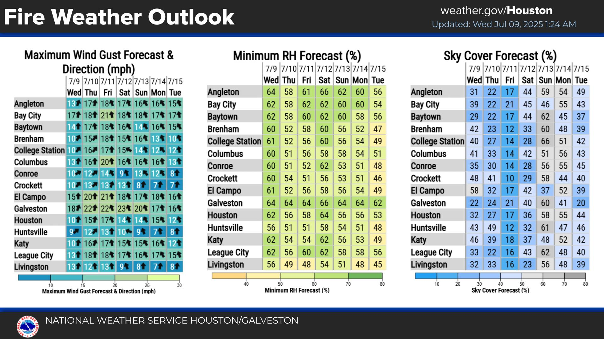
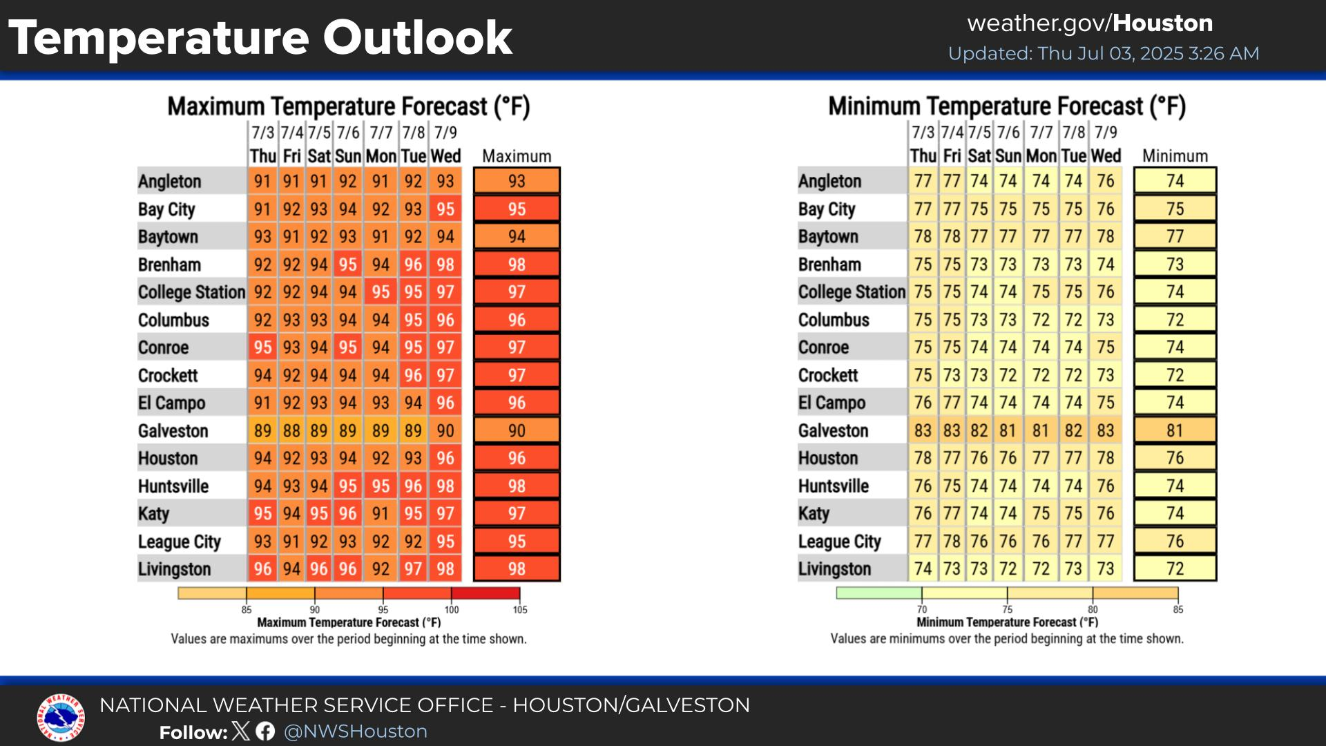
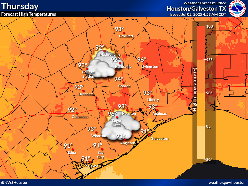
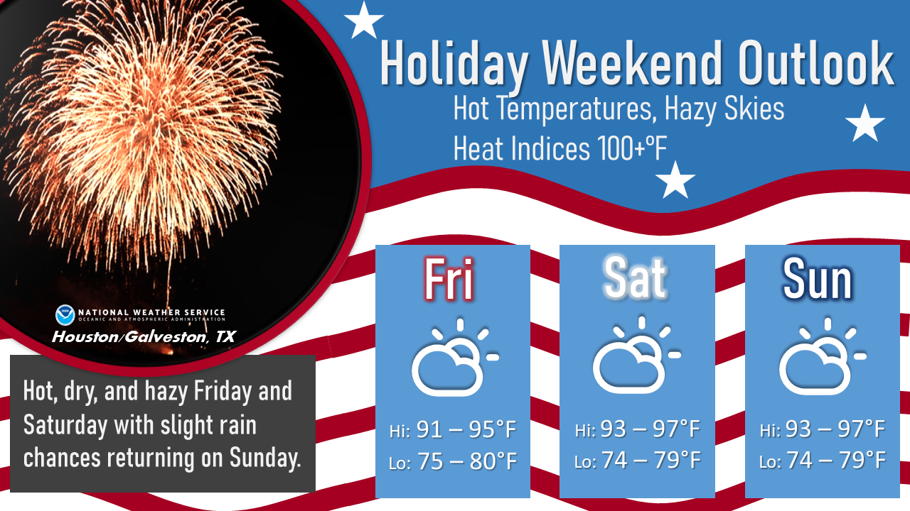
Hot weather expected daily with highs in the upper 80s/90s and lows in the 70s/lower 80s. Hot and dry throughout most of next week with rain returning late in the work week.
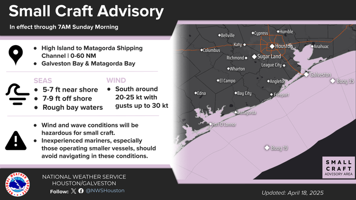
Marine Weather Outlook
South winds 10-20 knots gusting up to 25 knots.
Seas 2-5 ft.
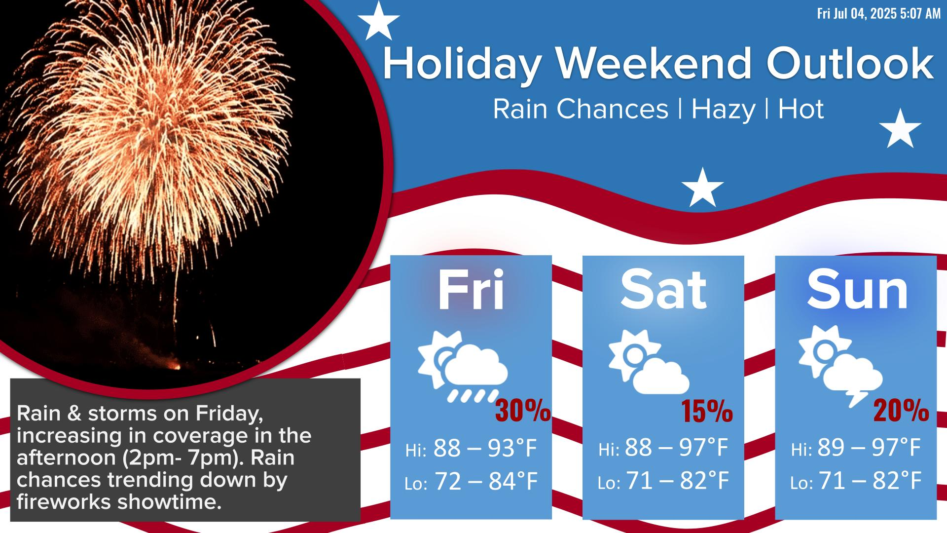
Rain chances 15% or less through Wednesday, increasing on Thursday through Friday to 30-70%.
Rain chances 10-30% today, decreasing to 15% or less afterwards.
Thank you for visiting a National Oceanic and Atmospheric Administration (NOAA) website. The link you have selected will take you to a non-U.S. Government website for additional information.
NOAA is not responsible for the content of any linked website not operated by NOAA. This link is provided solely for your information and convenience, and does not imply any endorsement by NOAA or the U.S. Department of Commerce of the linked website or any information, products, or services contained therein.


 Weather Map
 TX Satellite Imagery
 Monthly Hydrologic Reports
 Hurricane Preparedness
 CONUS Satellite Imagery
 Climate Graphs
 Climate Summaries